Map - Bélapátfalva

Bélapátfalva
Bélapátfalva is a town in Heves County, in Hungary, located north of the city of Eger. The town is located inside the Eger river valley at an altitude of 311 meters above sea level. Facing the town is the Bél-kő mountain which rises 811 meters and is one of the highest peaks of the Bükk mountains. Because of the picturesque landscape and notable attraction the village is on the path of the National Blue Trail.

The town is the site of the best-preserved Romanesque church building in Hungary, formerly part of a Cistercian abbey, established by Bishop Cletus Bél. The church was built after 1232 and later modified in Gothic style. The façade is notable for its Romanesque portal and the interplay between grey and reddish stone rows. The abbey to the south of the church was destroyed in the 16th century, and only its ruins remain. The design of the chapel of the Cistercian Our Lady of Dallas in Irving, Texas, was influenced by this church, which architect Gary Cunningham visited prior in preparation for the project.

 
Map - Bélapátfalva
Map
Google Earth - Map - Bélapátfalva
Google Earth
Openstreetmap - Map - Bélapátfalva
Openstreetmap
Map - Bélapátfalva - Esri.WorldImagery
Esri.WorldImagery
Map - Bélapátfalva - Esri.WorldStreetMap
Esri.WorldStreetMap
Map - Bélapátfalva - OpenStreetMap.Mapnik
OpenStreetMap.Mapnik
Map - Bélapátfalva - OpenStreetMap.HOT
OpenStreetMap.HOT
Map - Bélapátfalva - OpenTopoMap
OpenTopoMap
Map - Bélapátfalva - CartoDB.Positron
CartoDB.Positron
Map - Bélapátfalva - CartoDB.Voyager
CartoDB.Voyager
Map - Bélapátfalva - OpenMapSurfer.Roads
OpenMapSurfer.Roads
Map - Bélapátfalva - Esri.WorldTopoMap
Esri.WorldTopoMap
Map - Bélapátfalva - Stamen.TonerLite
Stamen.TonerLite
Country - Hungary
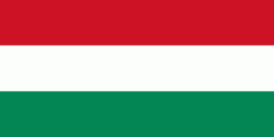
Flag of Hungary
Hungary (Magyarország ) is a landlocked country in Central Europe. Spanning 93030 km2 of the Carpathian Basin, it is bordered by Slovakia to the north, Ukraine to the northeast, Romania to the east and southeast, Serbia to the south, Croatia and Slovenia to the southwest, and Austria to the west. Hungary has a population of 9.7 million, mostly ethnic Hungarians and a significant Romani minority. Hungarian, the official language, is the world's most widely spoken Uralic language and among the few non-Indo-European languages widely spoken in Europe. Budapest is the country's capital and largest city; other major urban areas include Debrecen, Szeged, Miskolc, Pécs, and Győr.

The territory of present-day Hungary has for centuries been a crossroads for various peoples, including Celts, Romans, Germanic tribes, Huns, West Slavs and the Avars. The foundation of the Hungarian state was established in the late 9th century AD with the conquest of the Carpathian Basin by Hungarian grand prince Árpád. His great-grandson Stephen I ascended the throne in 1000, converting his realm to a Christian kingdom. By the 12th century, Hungary became a regional power, reaching its cultural and political height in the 15th century. Following the Battle of Mohács in 1526, it was partially occupied by the Ottoman Empire (1541–1699). Hungary came under Habsburg rule at the turn of the 18th century, later joining with the Austrian Empire to form Austria-Hungary, a major power into the early 20th century.
Currency / Language  
ISO Currency Symbol Significant figures
HUF Hungarian forint Ft 2
ISO Language
HU Hungarian language
Neighbourhood - Country  
  •  Austria 
  •  Croatia 
  •  Romania 
  •  Serbia 
  •  Slovakia 
  •  Slovenia 
  •  Ukraine